At Distance, we empower defence forces with real-time visual intelligence across different platforms. Our computational optics transforms helmets, sight devices, defence vehicles, and virtually every piece of see-through surface to amplify human perception to see more, understand faster, and act sooner.
Introducing Distance Field Operator HUD.
Superhuman Perception for Defence Applications.
One Platform, Every environment.
Traditional systems force operators to choose: look at the road or check the thermal feed. Monitor the map or watch for threats. Secondary screens create heads-down moments that break awareness and slow decisions. Distance eliminates that choice—everything appears where operators are already looking.
Across smoke and darkness, dense urban terrain, and contested maritime zones, Distance’s technology platform maintains continuous situational awareness. Thermal fusion enables all-weather operation, while European-built, NATO-compatible integration supports interoperability across allied forces. A unified software stack ensures capability upgrades reach deployed systems, not just new hardware.
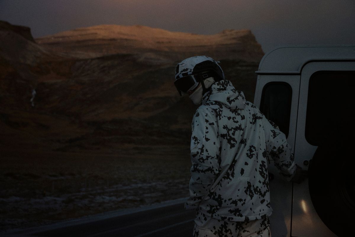
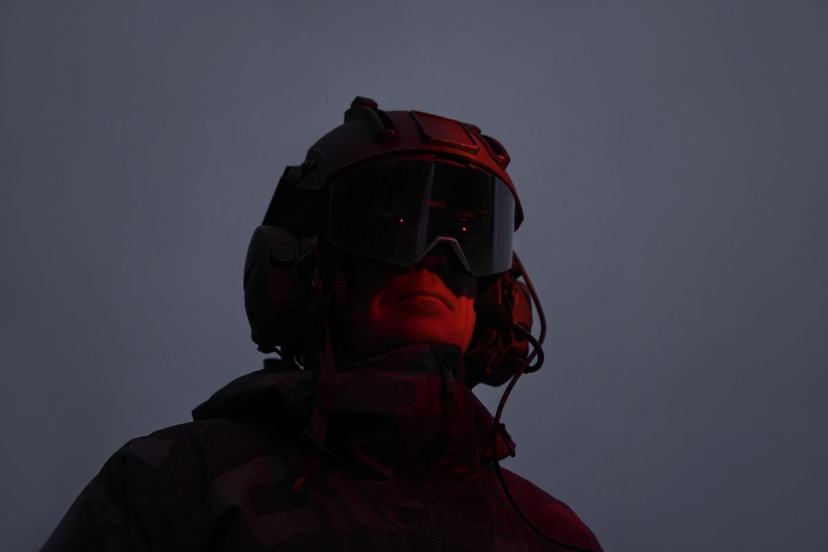
Distance and Galvion collaborate on next generation helmet system.
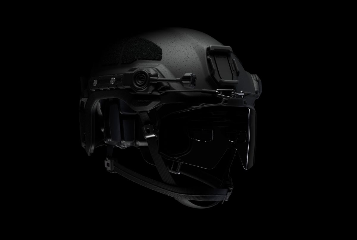
Field Operator HUD.
Between every soldier and battlefield.
Distance's Field Operator HUD brings the platform's core capabilities—thermal fusion, battlefield integration, drone interoperability—to a helmet-mounted display connected to the vehicle ecosystem. Lighter and more affordable than standalone systems because compute and power remain in the vehicle, not strapped to the operator.
In active development with defence partners across Finland and the UK through iterative field trials focused on scenarios where perception determines survival.
Situational awareness
Integration with TAK battlefield management systems ensures command-level intelligence flows to operators in real-time and seamlessly projects data— including Blue Force tracking, waypoints, and AI-classified threats—directly into the operator's line of sight.
Thermal fusion
A driver navigating at speed sees a thermal signature 150 meters ahead—body profile, potential anti-tank weapon. The system visualizes thermal sensor data and highlights the threat directly in the road ahead, not on a secondary monitor. Split-second awareness. Immediate reaction.
Drone view
Field Operator HUD integrates live video feeds directly into the operator's field of view—from drones overhead, vehicle-mounted cameras, or other external sensors. The bird's-eye perspective or remote camera angles appear alongside ground-level awareness, letting operators see over hills, around obstacles, and through occluded terrain without breaking focus.
Frontline-ready system
Field Operator HUD doesn't carry what it doesn't need. The system connects to the defence vehicle—drawing power, accessing vehicle-mounted sensors, leveraging existing compute infrastructure. Lightweight, frontline-ready, and compatible with existing night vision goggles.
In active development with defence partners across Finland and the UK through iterative field trials. Field trials 2025-2026, operational deployment 2027. Distance is seeking additional defence forces and primes to join co-development.
Beyond Human Sight. Witness the R&D of Distance Field Operator HUD.
Jetfighter HUD with Supacat Jackal.
The Operational Need
Supacat’s Jackal is top-heavy by design, built to carry weapons and crew while moving fast over rough terrain. From the driver’s seat, judging incline is almost impossible.
Under stress - contact, high-speed maneuvers, poor visibility - crews had no way to know when they were nearing rollover angles. Any solution had to work for drivers who can’t spare attention, and fit a vehicle with zero dashboard space.
The Solution: JetFighter HUD
Distance adapted waveguide display technology from fighter jets, scaled to dinner-plate size and suspended in the driver's eye line. Three critical pieces of information display simultaneously:
- Digital inclinometer - real-time tilt angle with visual alerts at dangerous thresholds
- Thermal camera feed - forward-looking infrared for hazards, obstacles, threats through smoke and darkness
- Vehicle telemetry - speed, engine status, safety data where the driver is already looking
The display works with night vision goggles and emits no light signature that would compromise tactical position. Two Distance engineers can integrate it into an existing Jackal in a single day.
Distance Jetfighter HUD in DSEI UK 2025 with Supacat.
Technical Implementation:
Large-format waveguide display requiring no dashboard space, NVG-compatible wavelength control, and integration with Ultra PCS Generic Vehicle Architecture (GVA) for command-and-control data feeds. Six weeks from initial concept to operational prototype.
Lightfield HUD with General Dynamics.
The Operational Need
Current night vision systems limit drivers to walking speed and force drivers to look away from the road, down at monitors positioned outside their natural field of view.
In unarmored vehicles where "speed is survival" - The British Army's Land Mobility Program needed a system that would let drivers operate at normal tactical speeds in conditions that currently force them to crawl.
The Solution: Lightfield HUD
Distance's Lightfield HUD transforms the windshield into a full-field-of-view 3D display. Multiple sensor feeds - thermal, infrared, visible spectrum - fuse in real-time.
The driver's eyes never leave the road. There are no secondary monitors to glance at, no heads-down moments to check a thermal feed or verify a waypoint. Every piece of information they need is already where they're looking.
Three core capabilities:
- Full-spectrum vision - thermal signatures, friendly positions, and waypoints rendered at their actual distance in three-dimensional space
- Eyes-forward operation - battlefield management data, drone tracking, and navigation overlays without secondary monitors
- True 3D perception - independent lightfields for each eye with per-pixel depth control across entire viewing range
Eye tracking predicts where the driver will be looking when each frame renders, compensating for vehicle movement and system latency. The entire system occupies 3-7 liters versus 20-30 liters for traditional solutions, enabling same-day retrofits.
Distance Lightfield HUD in DSEI UK 2025 with General Dynamics Land Systems.
Technical Implementation:
Eye tracking with predictive gaze positioning and latency compensation for vehicle movement at 100+ km/h, delivering a separate lightfield per eye and fusing thermal, IR, visible, and battlefield management data. Approx. 2000 horizontal pixels per eye. Six weeks from concept to implementation.
Gain a clear tactical advantage.
One Platform, Every Surface.
The same Distance platform can be integrated into almost any defence system – from helmets and scopes to vehicles, ships, aircraft and command centres. It retrofits into existing fleets and sensor suites, and is already being developed in the field with partners in Finland, the UK and beyond. Proven with the British Army, deployed across Finland and the UK, and expanding to defence forces who need versatile capability now, not years from now.
Vehicle
Our technology naturally integrates into your existing vehicle viewing and sensor systems to give operators increased awareness on the battlefield. All situational data can be split between the driver and commander so that they see what's most critical and relevant for them without adding any extra burdens or distractions, and the platform can be rapidly retrofitted into existing fleets.
Helmet
Adding Distance technology to helmet visors marks a new age of situational awareness for frontline soldiers. Designed to be lightweight and compatible with existing NVGs, it displays vital information across their entire field of view so soldiers can make critical decisions in real time, improving both tactical advantage and safety.
Scope
Distance can also be integrated into gun scopes to provide additional targeting information and improve high-stakes decision making. For example, displaying the remaining ammo count at a glance and marking targets as either friendly or enemy, making a critical distinction instantly visible without pulling focus from the mission.
Maritime
Similarly, our technology has many benefits for maritime defence, accelerating the way the naval battlefield can be viewed. Whether in training or deployment, Distance overlays live data and sensor feeds onto the real world to significantly increase situational awareness for better decision making and mission outcomes.
Aerospace
By working closely with our aerospace partners, we can add mixed reality to airborne systems. Augmenting the real world with Distance technology makes it possible to add vital additional information to applications like mid‑air refuelling, reconnaissance and other complex airborne operations.
HQ command centre
Adding Distance to command centres gives commanders and other military leaders a massive operational and strategic advantage. By displaying the most relevant and mission-critical information in real time, in a more realistic way that matches what units see in the field, it enables better decision making and outcomes across a range of combat scenarios.
Seeing is believing. To really open your eyes to what’s possible, you have to see Distance for yourself. Please contact our sales team to request a demo.